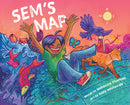
Description
Written by Rebecca Thomas and illustrated by Azby Whitecalf. Rebecca Thomas (Lennox Island First Nation) is an award-winning Mi'kmaw poet. She is Halifax's former Poet Laureate (2016-2018) and has been published in multiple journals and magazines. Azby Whitecalf (they/them/theirs) is a Plains Cree character designer and illustrator based out of North Battleford, Saskatchewan in Treaty 6 Territory.
Sem is confused. The map Mr. Trainer has just put on the screen is all wrong. It's the same shape as Turtle Island but it's nothing but boxes and lines, and it's filled with names he doesn't know. There's no reference to the stories of the land his Kiju tells him every night while she braids his hair. But Sem's teacher and classmates claim there's nothing wrong. It's the same map they've always used.
Sem tries to see the land the way Mr. Trainer showed him, but it just doesn't feel right. Where is the story of how the moose gets his dinner? Or where the fish run in the spring? Or when to tap the trees for syrup?
With the help of Kiju, Sem will show his teacher and his classmates how the stories of the land, the Indigenous place names, are far older than any map.
A gentle calling-in, this assured story from Governor General's Award finalist Rebecca Thomas is paired with colourful, lively illustrations from Azby Whitecalf, as well as colonial and decolonial maps of Turtle Island (North America) for reference. Sem's Map is an invaluable resource for caregivers, educators, and young readers about the importance of acknowledging the traditional lands we live on, and unlearning colonial ways of the past.
This book contains Watercolour illustrations. Audience: Ages 5-9.
Reference map for the Map of Turtle Island is the Decolonial Atlas, cartographer Jordan Engel, used with permission.
Further information from GoodMinds.com: An additional resource for an Indigenous map was produced by the University of Maine, Canadian-American Center called 'Coming Home to Indigenous Place Names in Canada' by Indigenous scholar Dr. Margaret Pearce, a Citizen Potawatomi tribal member and cartographer living on Penobscot homelands in Maine. The place names in this map are the intellectual and cultural property of the First Nations, Inuit, Métis, on whose territories they are located. The map depicts Indigenous place names across Canada, shared by permission of First Nations, Métis, and Inuit communities and people. The names express territorial rights and describe the shapes, sounds, and stories of sovereign lands. The names mark the locations of the gathering places, the communities, the places of danger and beauty, and the places where treaties were signed. The names are ancient and recent, both in and outside of time, and they express and assert the Indigenous presence across the Canadian landscape in Indigenous languages. The map does not depict all of the Indigenous place names of Canada, nor are all Indigenous Nations and communities represented. Beyond the map’s names are thousands upon thousands more, an ever growing and expanding atlas of intimate, geographical knowledge and experience. The intention of the map is to create respect for Indigenous homelands and sovereignties, and a feeling for and understanding of the place names.


